Difference between revisions of "File:Early historical israel.png"
Jump to navigation
Jump to search
Graham grove (talk | contribs) (Approximate area under direct central royal administration during the United Monarchy of Israel) |
(Category:Maps) |
||
| Line 1: | Line 1: | ||
Approximate area under direct central royal administration during the United Monarchy of Israel | Approximate area under direct central royal administration during the United Monarchy of Israel | ||
| + | |||
| + | [[Category:Maps]] | ||
Revision as of 21:08, 15 August 2008
Approximate area under direct central royal administration during the United Monarchy of Israel
File history
Click on a date/time to view the file as it appeared at that time.
| Date/Time | Thumbnail | Dimensions | User | Comment | |
|---|---|---|---|---|---|
| current | 18:39, 28 January 2006 | 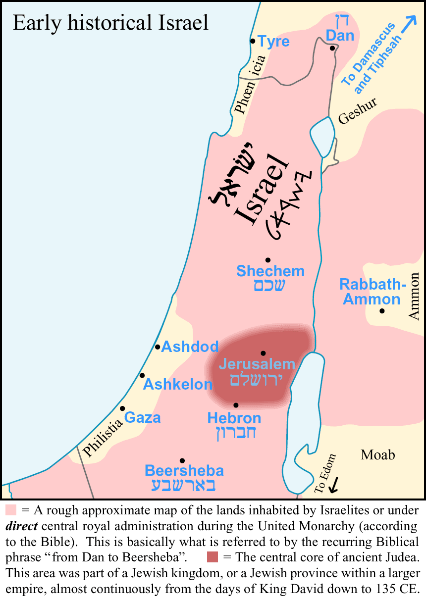 | 860 × 1,210 (58 KB) | Prab (talk | contribs) | |
| 13:45, 6 October 2005 | No thumbnail | (58 KB) | Graham grove (talk | contribs) | Approximate area under direct central royal administration during the United Monarchy of Israel |
- You cannot overwrite this file.
File usage
The following file is a duplicate of this file (more details):
- File:Early-Historical-Israel-Dan-Beersheba-Judea.png from Wikimedia Commons
There are no pages that use this file.